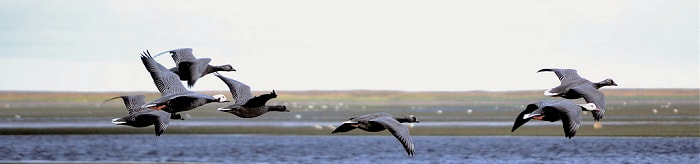
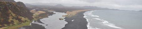
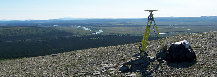
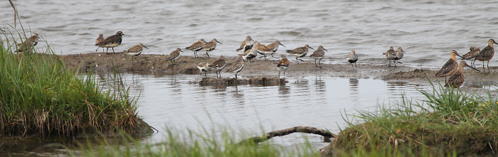
WESTERN ALASKA PARTNERSHIP
  • Home
  • Who we are
    • Mission, Charter & Goals
    • Staff & Steering Committee
  • Our work
    • Overview
    • Coastal
    • Terrestrial
    • Freshwater
  • Opportunities
    • Become a partner
    • Webinars
  • Resources

Coastal Projects

​​​​​Current Coastal Change Research and Priority Information Needs in western Alaska

8/1/2019

 
Picture
Research on coastal change in Western Alaska has increased rapidly in recent years, making it challenging to track existing projects, understand their cumulative insights, gauge remaining research gaps, and prioritize future research. This project identified existing coastal change projects in Western Alaska that were happening in 2014, scheduled for 2015 or occured in 2012-2014.  ​
​Project ID: WA2014_35​
Lead Investigator: Sarah Trainor, Alaska Center for Climate Assessment and Policy
Collaborators: Corrine Knapp, Alaska Center for Climate Assessment and Policy; Casey Brown, University of Alaska Fairbanks
​Project Duration: 2014 - 2015

Read More

​ShoreZone mapping on the southern Alaska Peninsula

8/1/2019

 
Picture
Mapped features include features such as shore types and morphology (e.g., dunes, beaches, and estuaries), intertidal biota (e.g., salt marshes, eelgrass beds, kelp beds) and man-made features (e.g., seawalls, docks). In addition to the dataset, the web-accessible, high resolution low-tide imagery (video and photos) will complement the mapped data.  The primary project goal is to provide systematic coastal habitat imagery and mapping for the Alaska Peninsula shoreline following the Alaska ShoreZone Mapping Protocol and to make this product web-accessible.  The completed mapping product will be available on the ShoreZone website in a searchable dataset. Individuals and communities will be able to query coastal habitat information for use in coastal zone planning. 

​Project ID: WA2013_27 ​
Lead Investigator: Cindy Hartmann-Moore, NOAA NMFS
Collaborators: Steve Lewis & Mandy Lindeberg, NOAA NMFS; Tina Moran, Leticia Melendez & Danielle Jerry, USFWS; Darren Stewart, The Nature Conservancy; John Harper Coastal and Ocean Resources Inc.; Mary Morris, Archipelago Marine Research, Ltd.
Project Duration: 2013 - 2015

Read More

​​Reconnaissance static occupation of Tidal Benchmarks in Western Alaska

8/1/2019

 
Picture
Understanding the causes of relative sea level rise requires knowledge of changes to both land (uplift and subsidence) and sea level. However, measurements of coastal uplift or subsidence are almost completely lacking in western Alaska. 
​Project ID: WA2013_26
Lead Investigator: Nicole Kinsman, Alaska Department of Natural Resources
Collaborators: Jeff Freymueller, University of Alaska Fairbanks
Project Duration: 2013 - 2014

Read More

Expanding environmental monitoring instrumentation on Kigigak Island

8/1/2019

 
Picture
Baseline hydrologic and topographic data in relation to waterfowl productivity is very limited on the Y-K Delta.  When considering the potential impacts of climate-driven change to nesting and brood-rearing habitats, these baseline data are important for making informed management decisions.  
​Project ID: WA2013_25
​Lead Investigator: Kyle Spragens, USFWS
Collaborators: Tuula Hollmen, University of Alaska Fairbanks; Thomas Ravens, University of Alaska Anchorage; Sarah Conn, USFWS
Project Duration: 2013 - 2015

Read More

Extensive mapping of Bering Sea and Gulf of Alaska coastal change by Landsat time series analysis, 1972–2013

8/1/2019

 
This project resulted in an extensive mapping of coastal change along the entire coastline of the Western Alaska Landscape Conservation Cooperative (LCC). The work provides important baseline information on the distribution and magnitude of landscape changes over the past 41 years. The extent of change to the coastline and to coastal features, such as spits, barrier islands, estuaries, tidal guts and lagoons, was known to be substantial in some areas along the coast (e.g., portions of the Yukon–Kuskokwim Delta), although the extent of change along the full Bering Sea coast was not well documented. 
​​Project ID: WA2013_24
Lead Investigator: Matthew Macander, ABR, Inc.
Project Duration: 2013-2014

Read More

​​​Community Observation and Vulnerability Assessment

8/1/2019

 
No one has better knowledge, and opportunity to document, how coastal storms affect the coast than the people who live in coastal communities. By training the network of Local Environmental Observers (LEOs) to collect coastal storm data in Western Alaska, we improve local capacity to engage in coastal observations. Through this project, the LCC supported the development of the Climate Change & Health Impact Assessment report for the Bering Straits region.  The report can be downloaded at the bottom of this page.
​​Project ID: WA2012_23 ​
Lead Investigator: Michael Brubaker, Alaska Native Tribal Health Consortium
Collaborators: James Berner, Alaska Native Tribal Health Consortium; Kevin Zweifel, Norton Sound Health Corporation; Anahma Shannon, Kawerak, Inc.; Paul Eaton, Maniilaq Association; John Chase, Northwest Arctic Borough
Project Duration: 2012 - 2014

Read More

​​​The Impacts of Storm Surges on Breeding Waterbirds on the Yukon-Kuskokwim Delta, Alaska: Past Effects and Future Predicted Impacts

8/1/2019

 
Picture
This project will evaluate the potential impacts of climate change to nesting waterbirds by examining both historic responses of nesting waterbirds to storm surges and current habitat associations of nesting waterbirds in the Central Coastal zone of the Yukon-Kuskokwim Delta (Y-K Delta). Specifically, long-term datasets describing distribution and nesting data for waterbirds on the Y-K Delta will be used to examine waterbird breeding parameters (i.e., clutch size and nest density) before and after historic storms based on new information from storm surge models​. 
​Project ID: WA2012_22
Lead Investigator: Sarah Saalfeld, Manomet Center for Conservation Sciences
Collaborators: Julian Fischer, USFWS; Thomas Ravens, University of Alaska Anchorage; Stephen Brown, Manomet Center for Conservation Sciences
Project Duration: 2012 - 2015

Read More

​​ShoreZone Mapping in Bristol Bay

8/1/2019

 
Picture
This project uses existing ShoreZone coastal imagery to map 719 km of shoreline in Bristol Bay, from Cape Constantine to Cape Newenham. This section of coastline is an extremely important herring spawning area and an important component of the Bristol Bay fisheries. Intertidal and nearshore vegetation, on which herring spawn, will be catalogued as part of the ShoreZone mapping and, along with shore types, coastal substrate, and coastal biota, added to the state-wide ShoreZone dataset.​
Project ID: WA2012_21 ​
Lead Investigator: Cindy Hartmann-Moore, NOAA NMFS​
Collaborators: Tevis Underwood & Patrick Walsh, USFWS; Steve Lewis, NOAA NMFS
​Project Duration: 2012 - 2015

Read More

ShoreZone Mapping in Kotzebue Sound

8/1/2019

 
Picture
This project uses previously collected ShoreZone imagery to map nearly 1,600 km of coastline between Wales and Kotzebue. With additional mapping supported by the Arctic LCC and National Park Service, this effort will complete the Kotzebue Sound shoreline, which will be included in the state-wide ShoreZone dataset. The complete ShoreZone dataset will be used to conduct a coastal hazards analysis and create maps that identify areas undergoing rapid coastal erosion and areas that are sensitive to inundation by storm surge and sea level rise.​
​Project ID: WA2012_20​
Lead Investigator: Cindy Hartmann-Moore, NOAA NMFS​
Collaborators: Peter Neitlich & Tahzay Jones, NPS; Greg Balogh, USFWS; Steve Lewis, NOAA NMFS; Nicole Kinsman, Alakska Department of Natural Resources
Project Duration: 2012 - 2014

Read More

Compilation of NHD Compliant Shoreline from Cape Prince of Wales to Cape Espenberg Using NOAA Extracted Vector Shoreline

8/1/2019

 
The compilation of an accurate and contemporary digital shoreline for Alaska is an important step in understanding coastal processes and measuring changes in coastal storm characteristics. Consistent with efforts by the United States National Park Service (NPS) at Bering Land Bridge National Preserve (BELA) and Cape Krusenstern National Monument, high quality, defensible digital shoreline datasets are under development for select coastal parks in the State of Alaska. 
​Project ID: WA2012_19
Lead Investigator: Andrew Robertson, Saint Mary's University of Minnesota
Collaborators: Joel Cusick, NPS
Project Duration: 2012 - 2013

Read More
<<Previous
Proudly powered by Weebly
  • Home
  • Who we are
    • Mission, Charter & Goals
    • Staff & Steering Committee
  • Our work
    • Overview
    • Coastal
    • Terrestrial
    • Freshwater
  • Opportunities
    • Become a partner
    • Webinars
  • Resources